Recreational Walking and Cycling Map
Recreational Walking and Cycling Map
CAUTION- Many trails experienced significant damage in the fall of 2022 and not all have re-opened or have only partially re-opened. Please respect all signage and barriers on the trail system and do not go on closed trails or sections.
In partnership with the Government of PEI, Recreation PEI has created an interactive trail map with all publicly accessible trails and active transportation paths on Prince Edward Island.
This map is unique because it includes municipal, provincial, federal, other managed trails, and scenic heritage roads all into the same map so users can easily find what they are looking for without having to use multiple sites.
Most trails were mapped in the spring of 2021 using the latest in GNSS technology. The system was accurate to within 96cms in some cases! New trails are being added as they are completed.
This map was completed in partnership with Island Trails, Recreation PEI, the PEI Department of Health & Wellness- Sport, Recreation, and Physical Activity Division, Tourism PEI- PEI Provincial Parks, along with input from Cycling PEI, Parks Canada, and the Island Nature Trust.
Use the map now: Recreational Walking and Cycling Trails
Please note that the map application is best viewed on a mobile device.
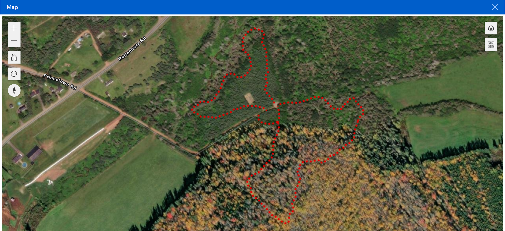
Here is an example of a mapped trail along with a description of some of the map features:
Devil’s Punchbowl Trail Map

Click on the photo above to access the interactive trail map which will open in a new link. From there you can use the following features:
- Click on the map button to open the map. The linked page may open blank but the map button open the map. If you are using a tablet, please ensure you are holding it vertically.
- Zoom in or out to see different details and find trails across PEI
- Click on any section of a trail to find the trail name, section name, length of the trail, length of the section highlighted and more.
- Use Legend to view different features of the map such as location of trail heads and parking lots, views along the trail, as well as nearby recreation facilities
- Change the Basemap layer to your preferred view. Above is “Imagery Hybrid” but it can be changed to “Topographic”, “Imagery”, “Streets”, and more.
- Find My Location shows where you are on the map. This feature can help if you’re lost or if you want to see how much of the trail you have left.
- Trail Search allows users to search for different trails by name. Once you have found the trail you’re looking for, click zoom to for a close up of the trail.
- Share allows you to share the map with others with the same settings you are currently using.
Something Missing?
The most common reasons for a trail to be missing from the map is that part (or all) of the trail is on private property and there is no use agreement in place or that it’s new and we haven’t gotten to it yet.
In the case of properties owned by Island Nature Trust, these are conserved natural areas whose primary purpose is land protection. These areas are not included on the map above due to the sensitive nature of the properties and the strict code of conduct required by visitors. You can find out more about them using this link.
If you still think something is missing or incorrect, please let us know at [email protected]. New trails and pathways are being constructed all the time and we don’t want to miss one!
The project was funded by:

